
Reviewed · SCENIC HELICOPTER FLIGHTS
Rotorua: Scenic Flight over Mt Tarawera & Waimangu Valley
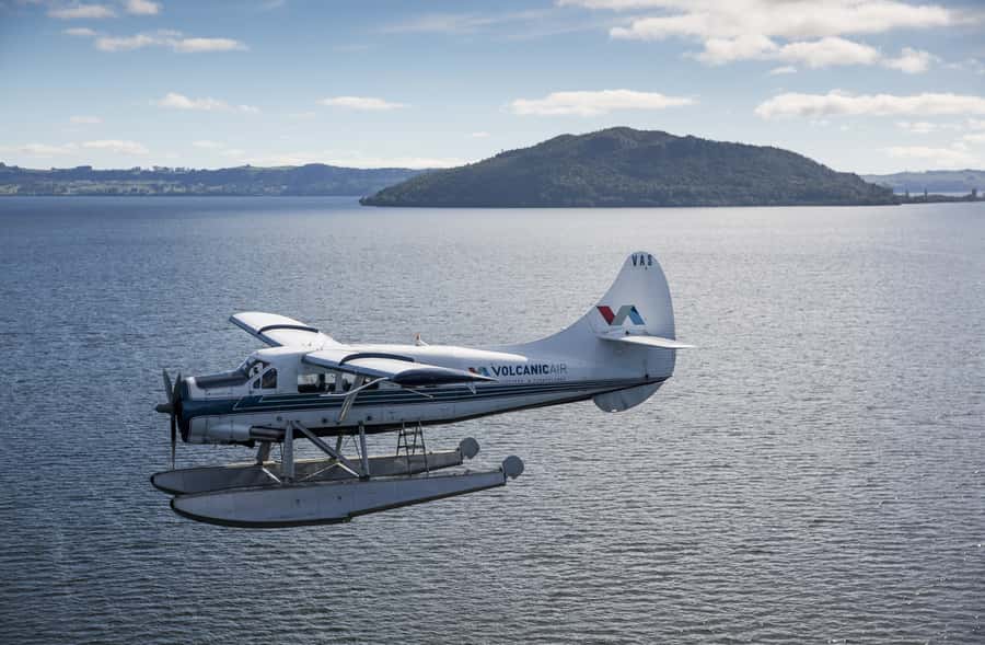
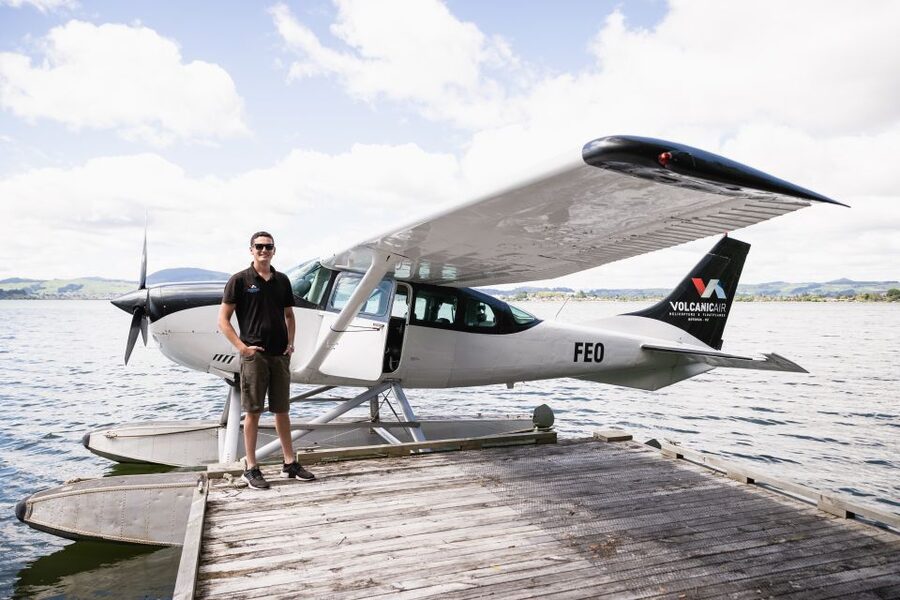
The most memorable part of this trip is the floatplane takeoff from Lake Rotorua. You skim across the water, lift above Mokoia Island, and trade the city for a chain of lakes, forest, volcanic peaks, and steaming geothermal ground. Then the pilot points the nose toward Mount Tarawera, where a huge crater rift records New Zealand’s most destructive eruption in living memory.
I like the two-part view: you see Rotorua from the water at the start and end, then get the best possible angle on places that are spread too far apart for one short walk. I also like the small group of no more than 10 and the window seat for every passenger. The main drawback is weather. Clouds or poor visibility can shorten the route, change the timing, or cancel the flight altogether.
Key points to know before you fly
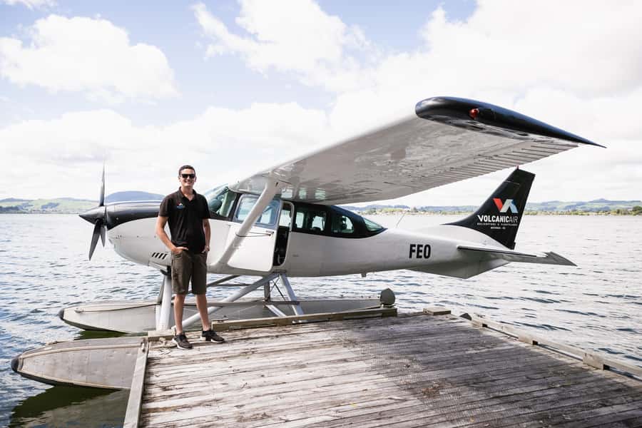
- Water takeoff and landing: Begin and finish on Lake Rotorua, an exciting feature in its own right.
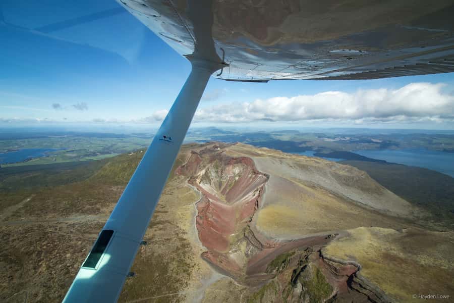
- Mount Tarawera from above: Look straight down on the 8-kilometer crater rift formed during the 1886 eruption.
- Waimangu’s famous craters: The route includes aerial views of Inferno Crater and Frying Pan Lake.
- Small aircraft, clear views: The flight carries up to 10 people, with window seats for all passengers.
- About 40 minutes total: Expect roughly 30 minutes in the air, plus the preflight process.
- Weather controls the day: The route can change if the views are poor or flying is unsafe.
Taking off from Lake Rotorua
Your outing begins at 1 Lakefront Drive, where you check in at the office building marked by large signs on the roof. The starting point is easy to understand once you are there: you are heading to the lake, not a distant airport runway.
Before takeoff, you receive a safety briefing. The listed schedule gives this part 20 minutes, while the full experience is described as 40 minutes with about 30 minutes of actual flying. Allow a little flexibility, since aircraft loading, weather, volcanic conditions, and the number of passengers can affect the timing.
The first thrill arrives before the main views. A floatplane needs water to get airborne, so you feel the aircraft skim across Lake Rotorua before it climbs. The return landing uses the same waterborne style, giving you two chances to experience the unusual part of the trip.
The aircraft carries no more than 10 people, and the available passenger setup gives everyone a window seat. That matters here. This is not a flight where you spend half the time looking over someone’s shoulder. You can keep your camera ready and switch sides with your eyes as the route turns.
Bring warm clothing. Even a short flight can feel cool, and you will want to focus on the views rather than your temperature. Bags are not allowed, so plan to carry only the essentials permitted by the operator. A camera is listed as a useful item to bring.
More scenic helicopter flights in Rotorua:
- Mt. Tarawera Volcano Scenic Floatplane Tour from Rotorua
★ 5.0 · 42 reviews - Mt Tarawera Helicopter Tour with Volcano Landing
★ 5.0 · 40 reviews - 15-Minute Crater Lakes Flight by Floatplane from Rotorua
★ 4.5 · 11 reviews
Mokoia Island and Rotorua’s lake district
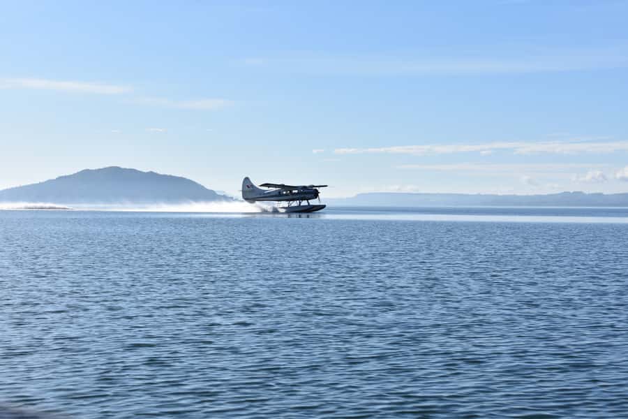
After takeoff, the aircraft climbs around Mokoia Island and crosses the ridge into the less familiar lakes district. From the air, Rotorua makes more sense as a network of water, bush, volcanic peaks, and open ground rather than a single town with a few attractions around it.
The flight offers views of Rotorua’s 13 lakes. You will not visit each lake on foot, of course, but seeing them in one sweep gives you useful context for the region. The lake pattern helps explain why Rotorua has long been tied to water, volcanic activity, and outdoor recreation.
Your pilot provides commentary in English, with an English audio guide also included. The spoken information covers Rotorua’s past and its geothermal parks, so you are not left guessing at every patch of steam or unusual color below.
This is also the first section where weather can make a real difference. Clear skies give you a broad view across the lakes and hills. Low cloud may reduce the sense of distance, and the operator can alter the route if views are not good enough to justify the flight.
Looking into Mount Tarawera’s crater
Mount Tarawera is the main reason to book this particular flight. The dormant volcano rises to 3,680 feet and dominates the area around the lakes. Seen from the ground, it is impressive. Seen from above, its long scar becomes the story.
The route takes you directly over the roughly 8-kilometer crater rift created by the 1886 eruption. That eruption devastated the surrounding area and destroyed the Pink and White Terraces, once widely described as the eighth wonder of the world. From the air, the crater’s scale helps you understand that this was not a small volcanic event.
You also get a view of the crater colors and broken volcanic shapes from an angle that a standard road tour cannot match. The changing shades are one of the strongest photo opportunities on the flight, though your pictures will depend heavily on sunlight, cloud cover, and how quickly the aircraft passes over the feature.
The pilot’s commentary adds value here. A scenic flight can otherwise become a silent list of pretty sights. The explanation of the eruption and Rotorua’s volcanic setting gives the views a clear human and geological context.
Do not expect to land on Mount Tarawera as part of this 40-minute experience. This is an aerial sightseeing trip, and any special excursion landing is at the pilot’s sole discretion and at your own risk. The published route focuses on viewing the volcano from above.
Waimangu Valley from the air
The flight continues to Waimangu Volcanic Valley, one of the strongest sections for seeing geothermal features in one glance. From above, the valley’s crater lakes and thermal colors form a compact visual record of volcanic activity.
Two named sights are included: Inferno Crater and Frying Pan Lake. Their shapes and colors are easier to appreciate from the air than from a single viewpoint on the ground because you can see how they fit into the wider valley.
I like this part for a practical reason. A ground visit to a geothermal park takes more time and involves walking. The aircraft gives you a quick aerial view without replacing a full visit if you later choose to explore the valley on foot. If your Rotorua schedule is tight, that broad overview can be a useful tradeoff.
The limitation is detail. You will see the craters clearly enough to understand their form and color, but you will not get the close-up sights, smells, paths, or interpretation that come with a ground tour. Think of Waimangu from the air as a strong survey, not a substitute for every geothermal experience in the area.
Same base, a different kind of day:
- Rotorua Canopy Tours: 2.5Hour Native Forest Zipline Adventure
★ 5.0 · 4,563 reviews - Mitai Maori Village: Cultural Experience and Dinner Buffet
★ 4.7 · 3,575 reviews - Rotorua: Wai-O-Tapu Geothermal Park Entry Ticket
★ 4.6 · 2,601 reviews - Rotorua’s Ultimate Zipline: 6 ziplines, 400 m Tandem, Cliff Walk
★ 5.0 · 2,557 reviews
The return over Whakarewarewa and Rotorua
On the way back, the aircraft passes the Whakarewarewa Thermal Valley and the Pohutu Geyser before flying over Rotorua city. This gives the return leg its own set of landmarks rather than simply retracing the outward route.
Pohutu Geyser is especially useful as a reference point. From the air, you see one of Rotorua’s best-known geothermal areas in relation to the city and the nearby lakes. The flight does not promise a ground-level eruption experience, so you should book a land visit separately if close-up geothermal viewing is important to you.
Flying over the city also brings the journey back to everyday Rotorua. After the wide lakes and volcanic craters, roads and buildings help you regain your bearings before the aircraft descends to Lake Rotorua.
The final floatplane landing is part of the attraction, not just the end of the transport. The aircraft returns to the water, and the trip ends with a short walk of about three minutes after disembarking.
How the flight feels in practice
The strongest praise for this experience concerns the smoothness of the flight, the quality of the views, and the pilot’s care. A passenger named David specifically praised pilot Ben for a smooth takeoff and landing, clear assistance during boarding and disembarking, and a well-explained trip. That assistance was especially meaningful because David had Parkinson’s disease.
You should not assume that every passenger will receive the same individual help, but the example shows the value of telling the staff about mobility needs before arrival. The activity is not suitable for wheelchair users, and it is also not recommended for people afraid of heights or those with altitude sickness.
The flight has a 4.9 rating from 25 reviews, with the strongest praise aimed at the scenery, the water takeoff and landing, the pilot commentary, and the smooth handling of the aircraft. One passenger flew a shortened route because of weather and still found the outing worthwhile. The operator also gave a partial refund when the full circuit could not be completed.
That is a useful sign of fair handling, but it also makes the central tradeoff plain: the advertised route is not guaranteed. Weather, volcanic activity, passenger loading, and safety conditions can change the flight time and inclusions. The aircraft will not go if the views cannot be seen or if conditions are unsafe.
Is $236 a fair price?
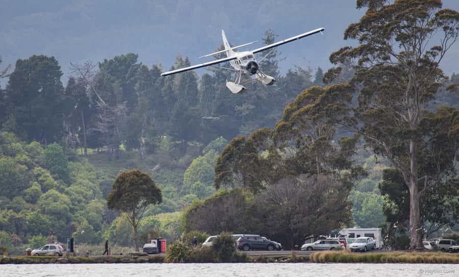
At $236 per person, this is not a casual add-on for most budgets. You are paying for a short flight, a small aircraft, a water takeoff and landing, and access to aerial views that are difficult to duplicate by road.
The price makes more sense if Mount Tarawera is high on your Rotorua wish list or if you have limited time for several separate attractions. In 40 minutes, you see the lakes, the volcano, Waimangu Valley, Whakarewarewa, Pohutu Geyser, and Rotorua city. A land-based day could show you more detail at one or two places, but it would not give you this single broad view.
The value is weaker if you dislike flying, need a guaranteed itinerary, or already plan to spend several days visiting the same areas from the ground. You might prefer to put the money toward a longer land tour or a full visit to Waimangu Volcanic Valley.
I see this as a special-occasion purchase rather than a basic sightseeing ticket. The floatplane element gives it more character than a standard aircraft flight, and the views cover a lot of Rotorua in a short time. Just book with the understanding that weather may change what you receive.
Who should book this Rotorua flight?
I would recommend it most strongly to photographers, first-time Rotorua visitors, and anyone fascinated by volcanoes. The route gives you both the big picture and several close aerial looks at volcanic craters.
It also suits people who want a memorable activity without giving up most of a day. The experience lasts about 40 minutes, with about 30 minutes in the air, so you can fit it around other Rotorua plans.
Families and small groups may appreciate the limited capacity, but everyone should be comfortable in a small aircraft and with heights. The operator lists the experience as unsuitable for wheelchair users, people afraid of heights, and people with altitude sickness.
New Zealand law requires individual passenger weights at booking. If a passenger weighs more than 110 kilograms, a surcharge may apply. Anyone weighing more than 135 kilograms is required to pay two adult fares, as measured by the operator.
Booking advice and final verdict
Try to leave some room in your Rotorua schedule rather than placing this flight immediately before an important connection. Weather can delay, shorten, or cancel the trip, and the route can change when conditions are poor.
You can cancel up to 24 hours ahead for a full refund, and the reserve-now, pay-later option keeps your plans flexible. Check availability for the starting times, bring warm clothing and a camera, and leave bags behind.
Book this tour if you want the rare combination of a floatplane experience and a clear aerial look at Mount Tarawera’s crater, Waimangu Valley, and Rotorua’s lakes. Skip it if you need a guaranteed full circuit or prefer close-up walks through geothermal parks. For the right passenger, the water takeoff, window seat, and volcanic views make the $236 worthwhile.
FAQ
Where does the floatplane flight begin?
The experience begins at 1 Lakefront Drive in Rotorua. Check in at the office building marked with large signs on the roof.
How long does the experience last?
The listed duration is 40 minutes, including about 30 minutes of flying. Timing can change because of weather, volcanic activity, and passenger loading.
What will I see from the aircraft?
The route includes Lake Rotorua, Mokoia Island, Rotorua’s lakes district, Mount Tarawera, Waimangu Volcanic Valley, Inferno Crater, Frying Pan Lake, Rotorua city, Whakarewarewa Thermal Valley, and Pohutu Geyser.
Does the plane take off and land on water?
Yes. The floatplane takes off from and lands on Lake Rotorua.
Is every passenger guaranteed a window seat?
The aircraft arrangement provides a window seat for every passenger.
What language is the tour conducted in?
The live guide and audio guide are in English.
Can the route change because of weather?
Yes. The flight is weather dependent and may not operate if conditions are unsafe or the views cannot be seen. The duration and route can also vary.
What should I bring, and are bags allowed?
Bring warm clothing and a camera. Bags are not allowed.
Is the experience suitable for wheelchair users?
No. The activity is listed as unsuitable for wheelchair users, people afraid of heights, and people with altitude sickness.
What happens if I need to cancel?
You can cancel up to 24 hours in advance for a full refund. You can also reserve the experience and pay later.
Just added in Rotorua
- Mt Tarawera Helicopter Tour with Volcano Landing★ 5.0 · 40 reviews
- Mt. Tarawera Volcano Scenic Floatplane Tour from Rotorua★ 5.0 · 42 reviews
- 15-Minute Crater Lakes Flight by Floatplane from Rotorua★ 4.5 · 11 reviews
- Whaka Geothermal Trails Self-Guided Tour★ 3.5 · 44 reviews
- Rotorua Highlights Inc. Te Puia & Secret Spot Hot Tubs Day Tour★ 4.5 · 129 reviews
- Lake Rotoiti Evening Kayak Tour including Hot Springs, Glowworm Caves and BBQ Dinner★ 5.0 · 60 reviews
- Mountain Jade Highlights Tour★ 5.0 · 31 reviews
- Rotorua: Redwoods Altitude High Ropes Adventure★ 4.9 · 165 reviews
Scenic Helicopter Flights, compared.
Franz Josef Glacier: Helicopter Flight & Alpine Landing
Read our review →
Franz Josef & Fox Glaciers Helicopter Flight & Snow Landing
Read our review →
Pilot’s Choice: 2 Glaciers & Snow Landing – 35min
Read our review →
Milford Sound Small Group Tour from Queenstown with Scenic Flight
Read our review →Browse the lists this tour appears in